Blaenau Ffestiniog, once a major centre of the slate mining industry, is set in an elevated natural bowl between the Manod and Moelwyn Mountains of Snowdonia. Although it lies at the the heart of Snowdonia, when the Snowdonia National Park was created, the Park boundaries were specifically arranged to omit Tanygrisiau, Blaenau Ffestiniog and Llan Ffestiniog and its substantial slate waste heaps from the Park, thus creating a doughnut-shaped area excluded from the National Park.The hills around Blaenau Ffestiniog form the watershed between the River Lledr flowing to the north (a tributary of the River Conwy) and the River Dwyryd flowing to the west.
Things to photograph
- Slate, and lots of it
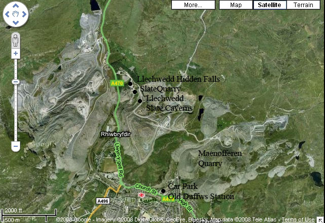
- Llechwedd Slate Caverns
- Old quarry workings – Rhosydd and Maenofferen quarries
- Ffestiniog Railway
- Derelict buildings
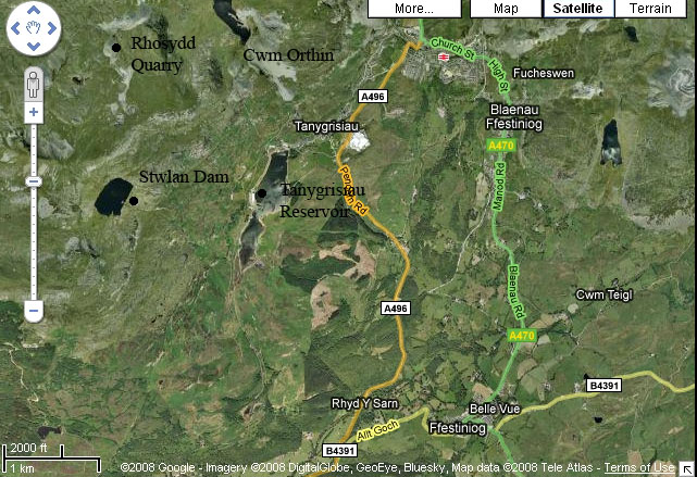
- Stwlan Dam
- Tanygrisiau Reservoir/Llyn Ystradau
- Cwm Orthin
- Typical quarry town, picturesque buildings
- LlanFfestiniog
- Rhaedr Cynfal
Special Photographic Features or Notes
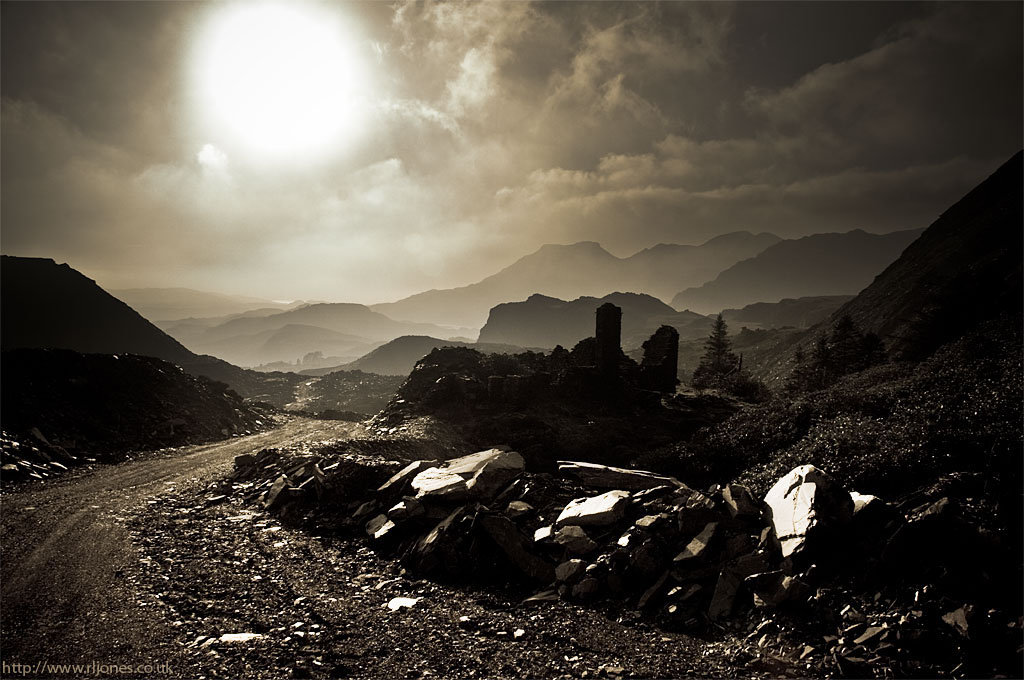
Slate
The entire landscape is dominated by slate, the slate waste tips and remnants of the slate industry that shaped the area. The village is the starting point for many walks up into the Moelwyns. There are stunning views over the Vale of Ffestiniog, harsh slate landscapes, rivers and bridges to be found.
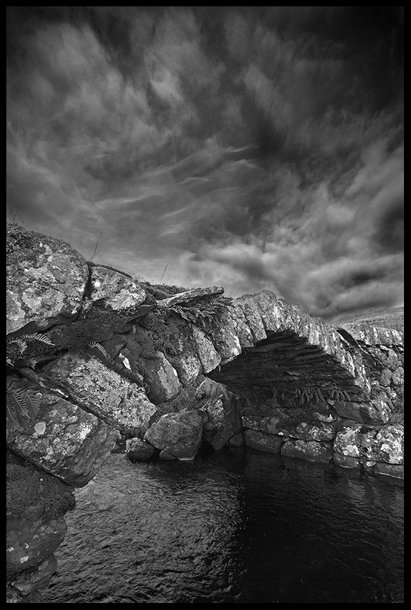
The Sheep Bridge above Blaenau Ffestiniog.
Llechwedd Slate Caverns
Set in 2000 acres of land above the town, this mine has been active since 1863, latterly as a tourist attraction. It offers two tours, the Deep Mine Tour and the Miner’s Tramway tour.
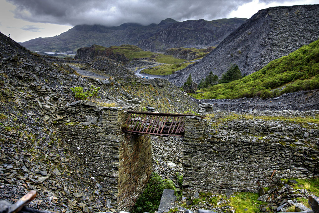
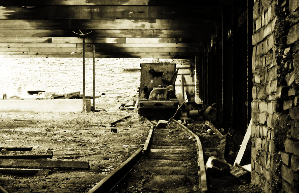
Slate Quarries
There are several quarries around this area such as Maenofferen, Rhosydd, and Cwm Orthin, with the remnants of the past industry clearly visible. There are old and derelict buildings, abandoned machinery, slate fences, lakes and streams to be photographed.
Ffestiniog Railway
The narrow gauge Ffestiniog Railway runs between Blaenau Ffestiniog and Porthmadog, having stations at Blaenau Ffestiniog and nearby Tanygrisiau. Originally used to transport slate, it is now a tourist attraction. The ride is spectacular as the line twists and turns its way through the countryside.
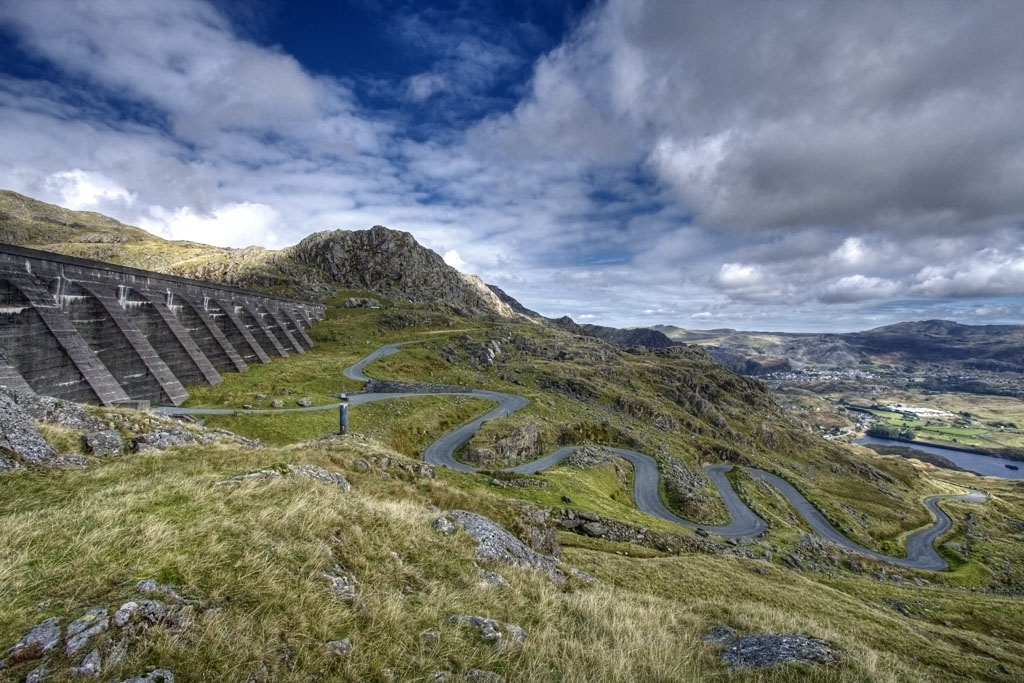
Stwlan Dam
Lying 1650ft above sea level, this dam is reached by a narrow two mile winding road with six hairpins bends. Stunning views of the Moelwyn range and the Vale of Ffestiniog from here.
Tanygrisiau and Llyn Ystradau (Tanygrisiau Resevoir)
Tan y grisiau is the Welsh for ‘below the steps’, which refers to the steps that used to lead up to the original slate mine above the village. The lake colloquially known as Tanygrisiau Reservoir, along with the Stwlan Dam above and the Ffestiniog power station are part of a pumped storage hydroelectricity installation. Close by is a waterfall on the Afon Cwmorthin, and walks to Stwlan Dam and to Cwm Orthin and Rhosydd start from here.
Cwm Orthin

Waterfall at start of path to Cwm Orthin
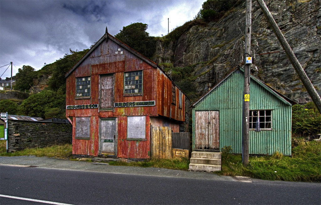
Typical quarry town, picturesque buildings
Many buildings in the town are the dark stone and slate roof traditional structures, along winding narrow streets that hug the mountainside. The history of the area is also to be seen in the buildings, with toilet block on the car park housed in the old Duffws railway station. There are flashes of colour to be seen if you look for them.
LlanFfestiniog
If less slate and more landscapes are your thing, then just take a short walk out of the town and you come to fantastic rocky outcrops, mountains, rivers and lakes, as best as the best of Snowdonia. Also known as Llan or simply Ffestiniog, this is a small village approximately three miles South of Blaenau Ffestiniog. Comprising rows of dark stone and slate roofed houses, it stands among some dramatic scenery. Eastward lies open moorland wilderness of the Migneint, and to the south and west the beautiful Vale of Ffestiniog, deeply sheltered with thick woodland, tumbling rivers and green fields.
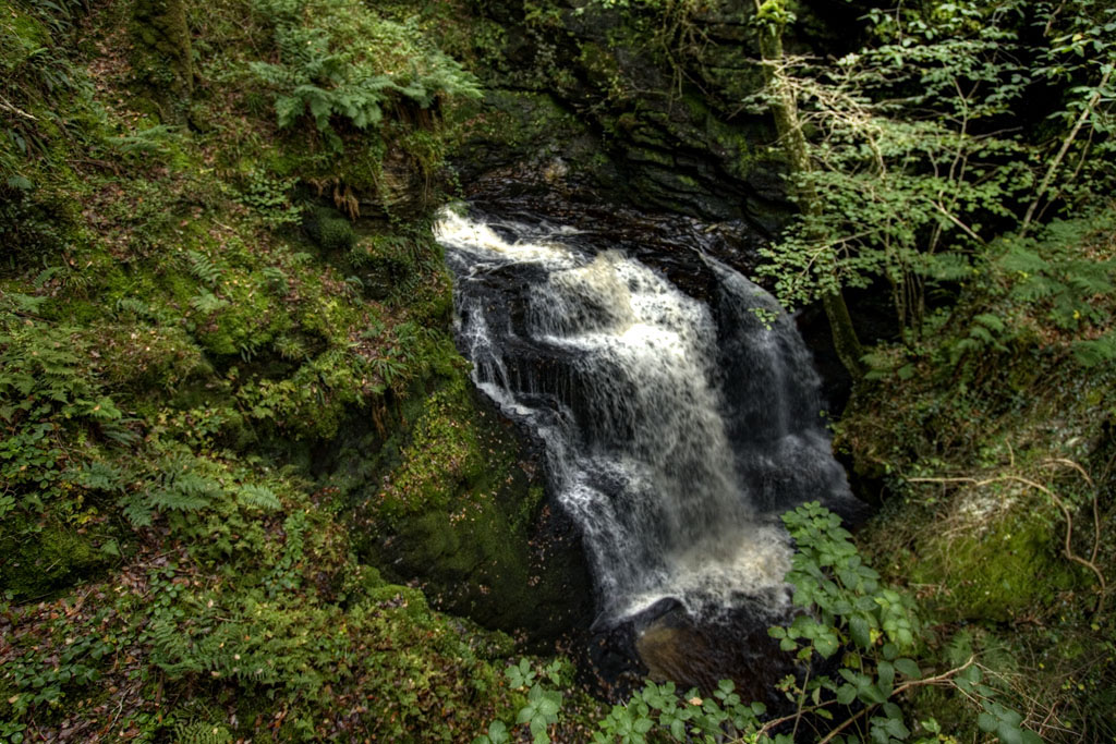
Rhaedr Cynfal
Accessible along a path from Llan Ffestiniog and lie in the Ceunant Cynfal Nature Reserve. It is a beautiful walk throught fields and wooded valley.
Special Equipment
- A varietly of lenses, wide angle lens is a must to capture the landscape
- Lens cleaning cloths (it always rains in Blaenau)
- Tripod. preferably a lightweight one
- Sturdy footwear – some of the slate road surface are fine but can get slippery when wet, or on the uneven slate
- Maps and directions
Best times to go there.
I would say anytime, though the weather will always be a factor. Snow on slate is nicely photogenic, and sunlight gives great shadows on slate and landscape. Misty weather, where trails of mist linger around the mountain tops makes for a great mood too. Even on a wet day, when the grey landscape is oppressive, there is a dark, cold beauty to this harsh landscape that receives a higher percentage of rainfall than anywhere else in Wales.
Getting There:
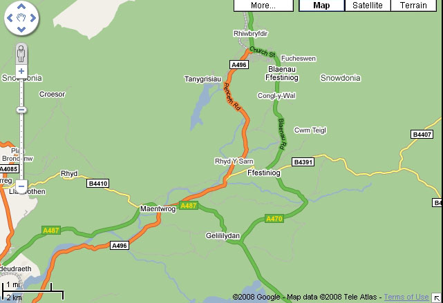
The main access route to Blaenau Ffestiniog is via the A470 road which runs from the north to the south of Wales. The A497, which runs West to East, feeds the Lleyn Peninsula into the A487 (which runs from Bangor through Caernarfon and into Porthmadog, which in turn connects with the north-south A470. Immediately to the north of the town the A470 climbs steeply to the Crimea Pass and meets the A5 at Betws Y Coed.
Rhaedr Cynfal: to visit Ceunant Cynfal National Nature Reserve, park by the Pengwern Arms in the centre of Llan Ffestiniog, and walk 50 yds down the B4391 towards Maentwrog
Bus services: can be seen here
Railway Services: the Railway station at Blaenau Ffestiniog is a joing station for the Conwy Valley Line from Llandudno Junction, and the narrow gauge Ffestiniog Railway from Porthmadog.
A few more images available here.


