Things to photograph
- Woodland
- The Eifl (Rivals) which have great views from on peaks
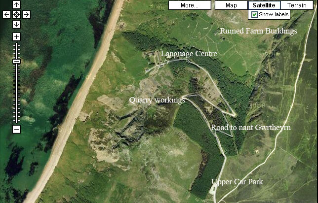
- The Language Centre
- Old quarry workings
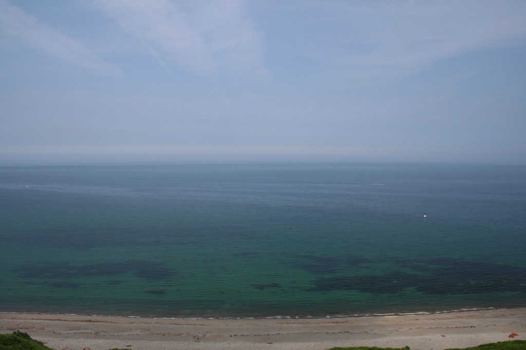
- Sea and shoreline
- Derelict farmhouse and farm buildings
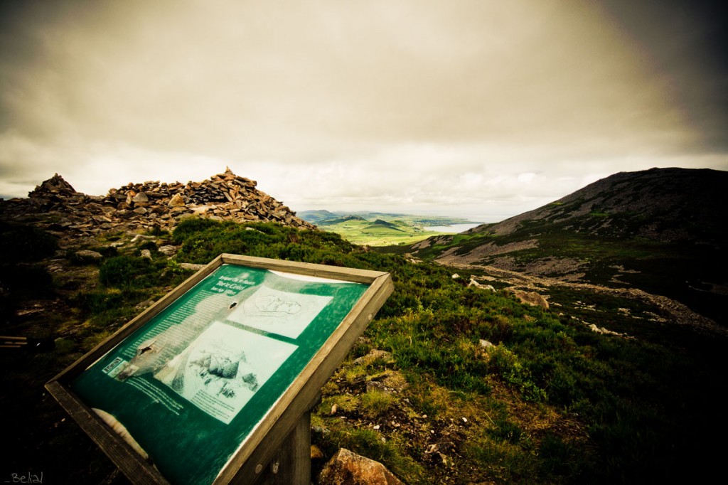
- Nearby (on the south east peak of Yr Eifl) is Iron Age fort of Tre Ceiri
Special Equipment
- Wide angle lens is nice to capture the landscape
- I like 35mm and 50mm prime lenses too
- Tripod
- Sturdy footwear – road surface fine but can get wet/uneven on woodland paths and beach
Best times to go there.
I would say anytime, and any weather. Early morning is always good for woodland, but it can be so dark in there that the time of day not really that much of a factor. Misty weather, where trails of mist linger around the mountain tops and through the trees works nicely, as does strong sunlight where the light filters in through the trees. I haven’t yet got there in the snow, that is an aim.
I don’t tend to do night shots, but know a man who does. So courtesy of Carl Jones; a night shot in Nant Gwrtheyrn
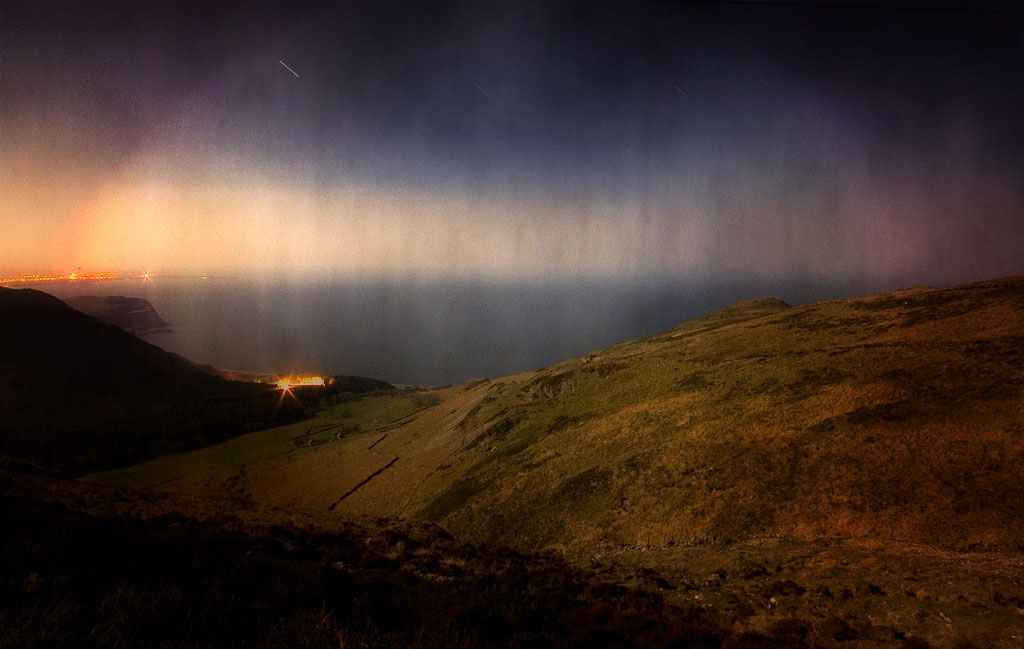
This shot, and all the technical detail can be seen at Shroud of Darkness
Special Photographic Features or Notes
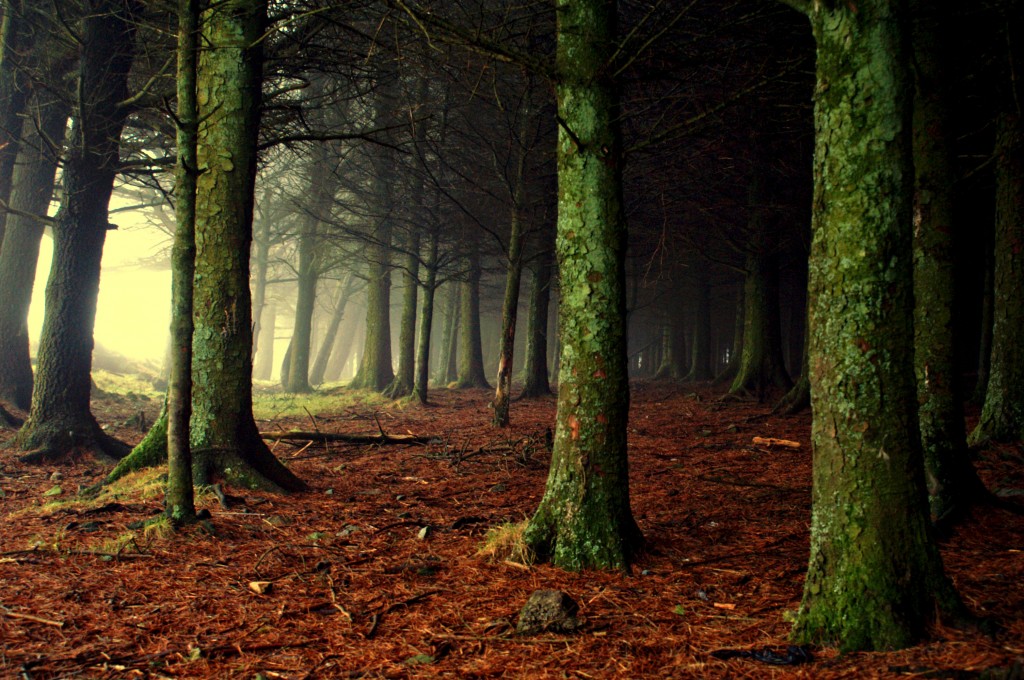
There is a coniferous woodland around the car park, and flanking the road down to the village, which I always find has an almost magical misty light. Although I have never actually seen anything within the woods (apart from a lot of sheep), there is an eerie and mystical silent beauty to them.
The Village
Located close to the village of Llithfaen on the Lleyn Peninsula, Nant Gwrtheyrn was a former quarry village, comprising two rows of houses, a chapel, a Plas (mansion) and a Co-op.
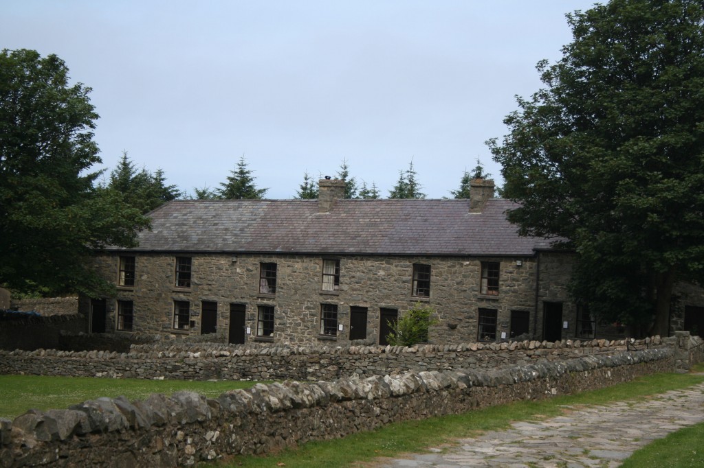
These have been restored, and since 1978 have been the home of the Nantional Language Centre. Backed by the Eifl (Rivals mountains), the village looks out over the sea towards Anglesey, and on a fine day Ireland may be seen.
Its earlier history goes back at least two thousand years; with close links to the settlement at Tre Ceiri (Town of the giants) and the Eifl which had rich stores of granite and iron.
More detail on this image from Carl Jones at Tre Ceiri
Some history and Folk lore
There are different explanations for ‘Gwrtheyrn’; one that the term derived from the name given to the stewards that the Romans left Britain in the charge of. ‘gor’ = ‘super’ and ‘teyrn’ = ‘king’. A second explanation is that Gwrtheyrn is Vortigern, and that Nant Gwrtheyrn means the Valley of Vortigern. One of the folk tales associated with the Nant is that the Brythonic king fled here after betraying his people to the Saxons.
One of the saddest folk tales associated with Nant Gwrtheyrn is that of Rhys Maredudd and Meinir Maredudd, cousins who lived on different farms in Nant Gwrtheyrn. They fell in love, and used to meet by the trunk of an old oak tree in the valley. Having decided to get married in nearby Clynnog Fawr, they followed the custom on the wedding morning, where the bride hides from the groom’s family who were her escort to church.
Meinir hid, was not found. Months later Rhys was beside the tree on a stormy night, lighting struck the tree, which split open to reveal a skeleton wearing a wedding dress. The shock proved too much for Rhys who died instantly. His dog Cidwm, his only companion since Meinir went missing, lay down beside him and died too. They were all buried together. There was apparently a curse laid on the Nant villaers by three monks, who said that there would never be sacred ground at the Nant for burial, that the village would succeed and fail thrice before it failed forever, and that no two people from the same family in the Nant would ever get married.
In 1770 Thomas Pennant, on his travels through Wales when he was writing his ‘Tours of Wales’ wrote about a cairn that he discovered at the bottom of Nant Gwrtheyrn that was known as Gwrtheyrn’s
grave, and on early OS maps the place was called Castell Gwrtheyrn.Several attempts were made to open quarries in the area, and a lot of the workers there were English and Irish.
There was a chapel there, and part of the minister’s work involved running a school for the children, when the valley was ‘between ministers’ the children faced a walk to Llithfaen to get to a school. After quarrying ended in the last century families drifted from the valley. It was given a new lease of life with its development as the National Language Centre.
Access
There is good vehicular access to the language centre at Nant Gwrtheyrn, following a steep, winding ‘new’ road, flanked by woodland. See the map for more detail. Walking from the upper car park (which I would recommend) will take about 20-30 minutes to go down to the village, and about 40-50 to return. There are some nice views of the valley, particularly from the first bend in the road.
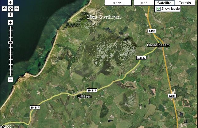
Route by car
Follow the A499 towards Pwllheli, looking out for the brown Nant Gwrtheyrn directional signs as you approach Llanaelhaearn. Turn off the A499 at Llanaelhaearn towards Nefyn (B4417). Having reached the village of Llithfaen, turn right at the crossroads opposite the shop and Post Office. Follow this road for about 2 miles (3.3km) past houses on the right and a car park on the left before the road becomes narrow and descends into the valley. Care should be taken on this road, as there aren’t many passing bays. There is a small car park on your right just before entering the village.
Welsh Language and Heritage Centre, Nant Gwrtheyrn, Llithfaen, Pwllheli, Gwynedd, LL53 6PA
Directions for Tre Ceiri and Yr Eifl
From Trekking Britain can be found here TreCeiri and Yr Eifl
Further images of Nant Gwrtheyrn are available at Nant Gwrtheyrn


