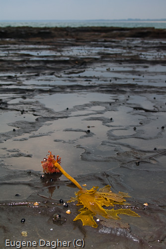
My family has a holiday house at Penguin Head, Culburra Beach. For years I’ve been taking photographs from this point and I never seem to run out of subject matter. The point consists of a vast flat expanse of intertidal rocks, made interesting by unusual volcanic gas bubble formations scattered around the site. Waves, sunsets, boulders, wildlife, fisherman, and beaches make taking photos here a treat.
Special photgraphic features or notes
Getting there
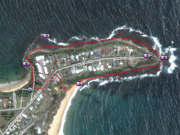
A Google map is available here.
Head east at Nowra along Kalandar Street, which turns into Greenwell Point Rd. Follow signs to Culburra. Once at Bulburra Beach go straight through the little township, making your way along Penguins Head Road. Access to the headland is best via a Council (free) car park as you round the bend heading towards the point. There is a park next to the carpark with BBQ facilities, and toilets. From the carpark make your way down the access ramp to the water. Head around the headland in a clockwise direction. The trip around back to the start is about 1.5km.
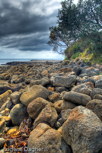
Towards the start near the carpark you will find calm water which is sheltered from southerly winds and swells. Here the shore is characterised by boulders and a grassy flat area with a picnic bench and table.
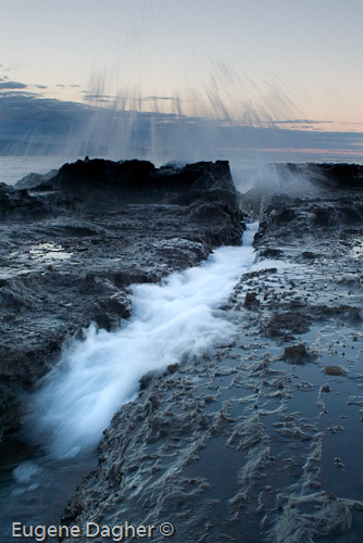
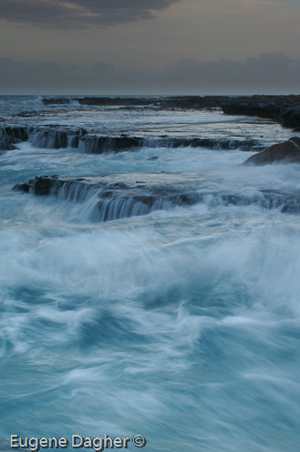
As you make your way around the headland you will become more exposed to the elements. When the swell is up and the tide is high you can get some terrific photos of waves crashing up against the rocks, and often water running across the flat shelf will make for good long exposures.
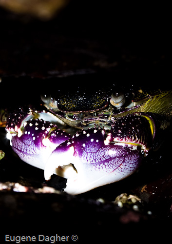
Be sure to check under and inside gaps formed by the boulders. During low tide crabs make for some intersting macro photography if you have the patience to wait for them to emerge.
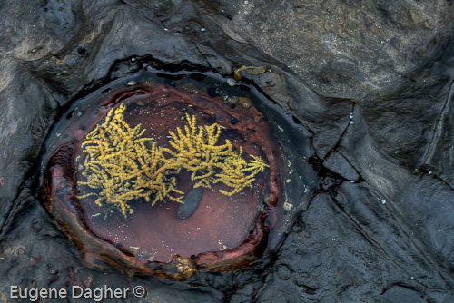
As you make your way towards the end of the point you will notice bubble-shaped rocks formed I presume by an underground volcanic activity millions of years past. The gas bubbles over time have been brought to the surface and now form interesting shapes and micro-environments for many animals and algae.
Once you round the point the wind usually picks up again as you are now facing south. This side of the point is less interesting in my opinion, but on this side you have a sandy beach, surfers, and fisherman. On this southern side it is often deserted, with the exception of summer holidays where a surf life saving club patrols the beaches on both sides of the point. Once you reach the beach keep your eye out for a little pedestrian track which takes you back up between two houses and onto Penguins Head Road and the car park.
Special equipment
Make sure you bring lens cleaning equipment, this site can be quite windy and when the swell is up salt spray becomes a problem.
Make sure you wear sturdy shoes, and take a rain coat if the weather looks threatening.
Best time of day
Best time of day is probably dawn as the sun rises in the direction of the point, but I guess it depends on the photographers shooting preference. All the photos above were taken during day light hours in different weather conditions.
Tidal information
During king tides, and higher tides the water can come right up onto the flat shelf and make passage along the headland difficult, and also limit photographic opportunities. The water when it covers the shelf however is rarely deeper than 30cm in the channels, and for the most part the water only covers your ankles. If you want to wade through the water be carful as it can get slippery and watch out for freak waves.
During low tides the water retreats right back down to the edge of the shelf. At these times it is possible to walk right up the the edge and take some good long exposure shots of the waves crashing up against the rocks – if the swell is up watch carfully for a few minutes before you approach the edge to see what the waves do before you stick your face in your viewfinder.
Wind information
It can get windy as the shelf in very flat and exposed. Check the www.bom.gov.au website for weather updates.
In the area
Woolumboula Lake (lagoon) is right next door. The best vantage points for the lake are along the beach, or from a little park at West Crescent, Culburra Beach. Of course in the area you also have the Shoalhaven River, and further south Jervis Bay.


Nice guide Eugene — Hey there Eugene, I can feel a South Coast trip coming up.
Looks like a great location.
Brent
Penguins Point, Culburra Beach — Hi Eugene
Just like to let you know I think your photos are beautiful.
I am a Culburra local and have been here for many years and I have never heard of Penguins Point. The areas where your photos have been taken are known as Penguins Head (also known as Wheelers Point) and Tilbury Cove but I can’t find any reference to Penguins Point anywhere.
Once again I think your photos are great. Well done. Your captured the essence of the area.
Thanks – very kind words. I’ve always known it as Penguin Point – but then I’m probably wrong. Penguin Head fits in with the street name so it makes sense.
Best time to visit… out of season. Free of tourists. A peaceful place 🙂
My uncle moved there in 1966 in lake circuit drive he paid $ 100 for his land. Also do you know that there is a grave on Penquin head I saw it in 1967. and it is still there today.
Hi, nice photos! Came across this while doing some research about Culburra Beach. I was also just reading another article about geology that referred to ‘cannonball’ concretions which “seem to be the result of minerals in the sediment recrystallising around a nucleus, frequently a fossil” which might be what you took a photo of?
What is the history of the olde rock archway on the left on Penguin head road??